English Version underneath
Vermisst ihr auch die Anzeige der Flugroute im Flugzeug, wenn ihr grad mal wieder was richtig Schönes aus dem Fenster erblickt?
Dann seid ihr hier richtig. Mit MyWay wird der Flug interessanter. Ihr könnt die Flugroute im Auge behalten. Start/Landung und Flug in Reiseflughöhe werden farblich dargestellt. Zeitstempel in der Kartengrafik und natürlich Daten zu Geschwindigkeit, Höhe, Entfernung zu Start/Ziel und der geschätzten Ankunftszeit runden die Anzeige ab.
Natürlich voll Flugmodus tauglich. Alle Flughäfen mit den entsprechenden Daten sind in der App auch ohne Internetverbindung abrufbar. Und wenn doch mal ein Ziel fehlt, dann gibt es den Onlinemodus, mit dem man Suchen wie in der Karten-App ausführen kann. Einfach oben auf "Flughafensuche" tippen und schon springt die Anzeige zur Onlinesuche um. Die geht aber natürlich nur mit funktionierender Internetverbindung. Also vor dem Flug ausführen!
Wenn ihr vor dem Flug die Karte in der App über die ungefähre Flugroute schiebt und das auch in einer höheren Auflösung, dann werden diese Ansichten im Cache gehalten und stehen euch auch während des Fluges zur Verfügung.
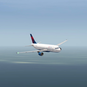
GPS im Flugzeug ist am besten in Fensternähe empfangbar.
Und nun viel Spass mit myWay. Fly your way with myWay ;-)
Do you miss the display of the flight route on the plane when you see something really nice out of the window?
Then you are right here. MyWay makes the flight more interesting. You can keep an eye on the flight route. Start / landing and flight at cruising altitude are shown in different color. Time stamps in the map and of course data on speed, altitude, distance to start / finish and the estimated time of arrival round off the display.
Of course, full flight mode suitable. All airports with the corresponding data are also available in the app without an internet connection. And if a goal is missing, then there is the online mode, with which you can perform searches as in the map app. Simply tap at the top of the "airport search" and it will jump to online search. Of course, this is only possible with a working Internet connection. So run before the flight!
If you push the map in the app over the approximate flight route before the flight and in a higher resolution, these views are kept in the cache and are also available during the flight.
GPS in the aircraft is best received near the window
And now have fun with it myWay. Fly your way with myWay ;-)