OceanTrack

OceanTrack


Offshore Sailing Navigator


FreeOffers In-App Purchases

1.4.4for iPhone, iPad and more
Haversine Ltd
Developer
183.8 MB
Size
Oct 18, 2020
Update Date
Navigation
Category
4+
Age Rating
Age Rating
4+
Apps in this category do not contain restricted content.
9+
Apps in this category may contain mild or occasional cartoon, fantasy or real-life violence, as well as occasional or mild adult, sexually suggestive or horrifying content and may not be suitable for children under 9 years of age.
12+
Apps in this category may contain occasional mild indecent language, frequent or intense cartoon or real-life violence, minor or occasional adult or sexually suggestive material, and simulated gambling, and may be for children under 12 years of age.
17+
You must be at least 17 years old to access this App.
Apps in this category may contain frequent and intense offensive language; Frequent and intense cartoon, fantasy or realistic violence: frequent and intense adult, scary and sexually suggestive subjects: as well as sexual content, nudity, tobacco, alcohol and drugs, may not be suitable for children under 17 years of age.
OceanTrack Screenshots
OceanTrack posterOceanTrack posterOceanTrack posterOceanTrack posterOceanTrack posterOceanTrack poster

About OceanTrack

OceanTrack is the ultimate marine navigation app for iOS, providing real time instrument reading, AIS traffic and passage information. With worldwide built-in map coverage, the ocean is the limit. Traffic awareness features allow you to stay safe and sail safely whether you're entering a busy shipping lane or sailing in the middle of the Pacific without Internet connectivity.

Developed and tested on a real sailing vessel, OceanTrack makes use of a combination of the device's internal GPS and Compass sensors to provide instant data on current position, speed over ground, course and heading, plotted on a stylish navigation Display.

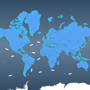
With Cloud AIS, providing you have Internet connectivity and there is land AIS coverage, OceanTrack comes with complimentary AIS information data with thousands of ships sailing around the world at any given moment. See ships anywhere and tap on them to discover who they are, how far they are or where they're going.

Through NMEA, OceanTrack can also connect to your boat's systems via an NMEA-to-WiFi bridge / server, collect real-time data from multiple onboard sensors, AIS receivers, and display accurate information on position, boat speed, depth below keel, wind speed and direction and surrounding marine traffic amongst other things.

OceanTrack includes an advanced Multi Function Display and Map (MFD) with:

- GPS Position Information
- Speed Over Ground, Course Over Ground, Heading
- Speed over Water, Depth Below Keel
- Apparent and True Wind Speed and Direction
- Beaufort Scale Estimation on screen
- DTW, BTW, XTE and VMG when next waypoint is available
- Dynamic zoomable range
- Built-in moving map for use when offline and offshore; the whole world is included, no need to download it
- Support for AIS-SART, AIS-MOB and AIS-EPIRB devices, plotting Man Overboard (MOB) positions on screen with relative bearing, distance and time to reach - a life saver!
- Plotting of AIS targets including ships, navigation aids, shore stations and Search and Rescue (SAR) aircrafts
- On-Map measurement of range, bearing and ETE at current speed to any point
- Quick multi-hop tap-hold-and-drag route planning anywhere in the world
- AIS info including Name, MMSI, SOG, COG, RNG, BRG
- AIS directed and broadcast messages display and alerts
- Advanced calculation of CPA and TCPA to any AIS ship
- Selection of rhumb-line (loxodromic) or great-circle (orthodromic) navigation
- Mercator Projection
- Various unit selections and display formats
- Portrait and Landscape orientations on iPad
access to onboard instruments with:

- An NMEA decoder to interface with onboard AIS receivers
- NMEA on TCP and UDP interfaces
- NMEA support for VDM, RMC, GSA, GSV, GLL, VTG, GGA, HDT, HDG, VHW, DBT, DPT, MWV, MTW and RMB sentences

and an AIS engine with:

- List of all surrounding AIS vessels sorted by distance
- Detailed AIS information on vessels including all static and dynamic performance indicators (MMSI, position, SOG, COG, country, dimensions, ...)

Requirements:

OceanTrack is iOS only and universal for any iPad, iPhone and iPod touch running iOS 9.0 or later.

To access onboard instruments and surrounding AIS traffic (other than cloud AIS which has limited coverage and requires Internet connectivity), OceanTrack requires a WiFi network, an NMEA to WiFi server and the NMEA Connector inApp purchase. Most modern plotters provide this bridging and WiFi funcionality nowadays but should they not, NMEA to WiFi adapters can usually be installed separately to provide access.
Show More

What's New in the Latest Version 1.4.4

Last updated on Oct 18, 2020
Old Versions
Includes iOS 14 and hardware support improvements.
Show More
Version History
1.4.4
Oct 18, 2020
Includes iOS 14 and hardware support improvements.
1.4.3
Sep 20, 2020
Maintenance update for iOS 14 and above.
1.4.2
Mar 6, 2020
Maintenance update with small fixes.
1.4.1
Feb 23, 2020
Includes various bug fixes and improvements.
1.4
Sep 4, 2019
- General bug fixes and performance improvements
- Smoother interface colours and a brand new icon
1.3.1
Jul 17, 2019
This version contains bug fixes and performance improvements.
1.3
May 21, 2019
- Adds native support for iPad Pro and Xs and Xr iPhone models.
- Provides improvements and bug fixes.
1.2
Sep 29, 2018
Adds support for the new Xs and Xs Max iPhone models.
1.1.1
May 19, 2018
Version 1.1:

- Introduces multi-leg tap-hold-and-drag routing with course to steer and distance
- Introduces search and rescue SART/MOB/EPIRB support and display on screen
- Updated colours of SAR targets to white and red for clearer and easier recognition
- Fixes issue with incorrect mothership MMSI on class B ships
- Fixes issue with incorrect display of AIS vendor
- Fixes issue with incorrect SAR aircraft heading
- Includes several bug fixes and improvements

Version 1.1.1 is a small update to 1.1 which:

- Fixes a display bug with coordinates in the SHIPS page on the iPad
- Changes te symbol for navigation aids making it clutter less
- Adds display of barometric pressure in the data page if available on the device
1.1
May 12, 2018
- Introduces multi-leg tap-hold-and-drag routing with course to steer and distance
- Introduces search and rescue SART/MOB/EPIRB support and display on screen
- Updated colours of SAR targets to white and red for clearer and easier recognition
- Fixes issue with incorrect mothership MMSI on class B ships
- Fixes issue with incorrect display of AIS vendor
- Fixes issue with incorrect SAR aircraft heading
- Includes several bug fixes and improvements
1.0.1
Apr 25, 2018
Improves accuracy of target last update times.
1.0
Apr 19, 2018

OceanTrack FAQ

Click here to learn how to download OceanTrack in restricted country or region.
Check the following list to see the minimum requirements of OceanTrack.
iPhone
Requires iOS 12.0 or later.
iPad
Requires iPadOS 12.0 or later.
iPod touch
Requires iOS 12.0 or later.
OceanTrack supports English
OceanTrack contains in-app purchases. Please check the pricing plan as below:
NMEA Connector
$19.99

OceanTrack Alternative

You May Also Like

Get more from Haversine Ltd