VicTraffic is the official traffic app from VicRoads.
The app stays up to date by automatically downloading new content when it is available.
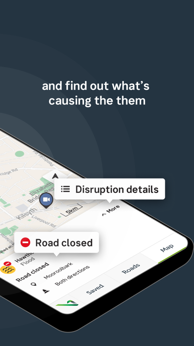
Road Closures and Traffic Alerts are generally uploaded to the application during peak traffic periods of Monday to Friday, 6:45am to 6:45pm and after hours during significant emergency events.
Details include location, impacts and any special instructions such as detours.
Pre-planned interruptions such as Roadwork’s and Events are available up to 48hours in advance.
Freeway travel times and live traffic camera images from around Melbourne provide you with a live image of how traffic is looking there and then.
Features include:
- Locality Search
- Zoom to your location (location services)
- Customisable settings for different data types
- Region and Municipality filters