AgriMaps
免費
9.0.1for iPhone, iPad and more
9.9
1 Ratings
The University of the West Indies
Developer
54 MB
Size
2018年07月25日
Update Date
Productivity
Category
4+
Age Rating
Age Rating
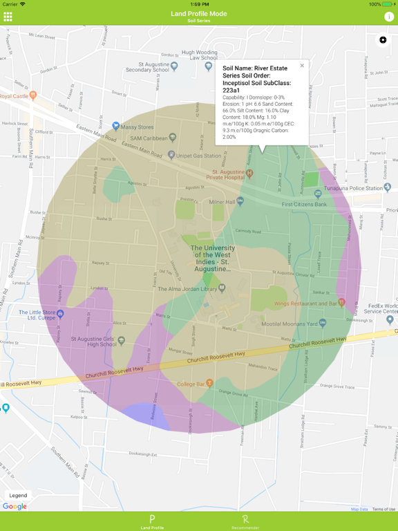
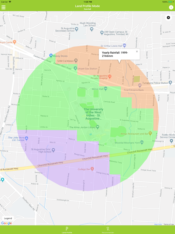
AgriMaps 螢幕截圖
About AgriMaps
AgriMaps provides you with the means to view various geographic properties about land in Trinidad and Tobago and provides crop information on such land to allow you to make informed decisions about planting crops. The application features two modes to provide this functionality called the Land Profile and Crop Recommendation modes.
The Land Profile mode uses your current or proposed GPS coordinates to display various geographic features – roads, rivers, soil series, contours and rainfall. Details on each feature is available where particularly the details of the soil series stands out, i.e. soil series name, pH, calcium content, land capability classification and sand content among others.
The Crop Recommendation Mode uses your current or proposed GPS coordinates to provide a recommendation on the most suitable crops to cultivate in a specific area. This analysis also provides recommendations on how the soil can be improved for a specific crop and takes into account the soil characteristics, rainfall, contours and distance from specific features e.g. nearest river.
Note: The AgriMaps application currently only provides data for land in Trinidad and Tobago. Loading from locations outside Trinidad and Tobago will not show any data to the user.
Show More
最新版本9.0.1更新日誌
Last updated on 2018年07月25日
歷史版本
This app has been updated by Apple to display the Apple Watch app icon.
Show More
Version History
9.0.1
2018年06月27日
This app has been updated by Apple to display the Apple Watch app icon.
AgriMaps FAQ
點擊此處瞭解如何在受限國家或地區下載AgriMaps。
以下為AgriMaps的最低配置要求。
iPhone
須使用 iOS 9.0 或以上版本。
iPad
須使用 iPadOS 9.0 或以上版本。
iPod touch
須使用 iOS 9.0 或以上版本。
AgriMaps支持英文


