AgriMaps provides you with the means to view various geographic properties about land in Trinidad and Tobago and provides crop information on such land to allow you to make informed decisions about planting crops. The application features two modes to provide this functionality called the Land Profile and Crop Recommendation modes.
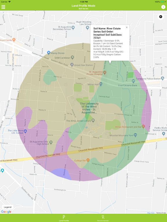
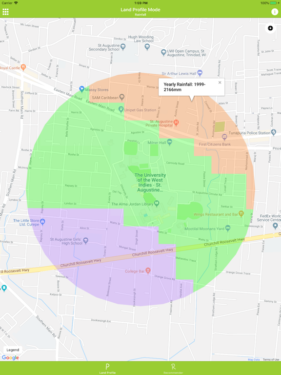
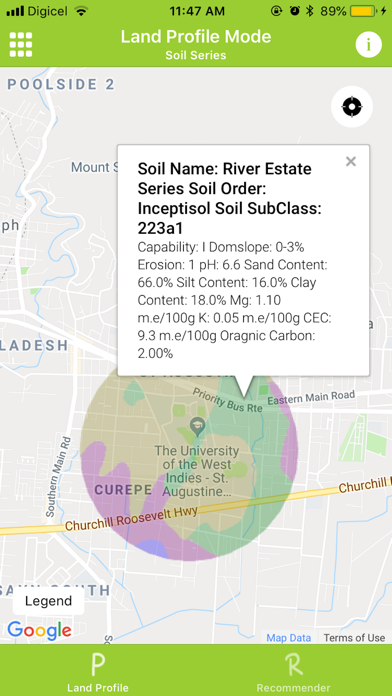
The Land Profile mode uses your current or proposed GPS coordinates to display various geographic features – roads, rivers, soil series, contours and rainfall. Details on each feature is available where particularly the details of the soil series stands out, i.e. soil series name, pH, calcium content, land capability classification and sand content among others.
The Crop Recommendation Mode uses your current or proposed GPS coordinates to provide a recommendation on the most suitable crops to cultivate in a specific area. This analysis also provides recommendations on how the soil can be improved for a specific crop and takes into account the soil characteristics, rainfall, contours and distance from specific features e.g. nearest river.
Note: The AgriMaps application currently only provides data for land in Trinidad and Tobago. Loading from locations outside Trinidad and Tobago will not show any data to the user.