ArcGIS Field Maps
免費
24.1.1for iPhone, iPad and more
Age Rating
ArcGIS Field Maps 螢幕截圖
About ArcGIS Field Maps
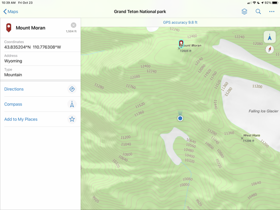
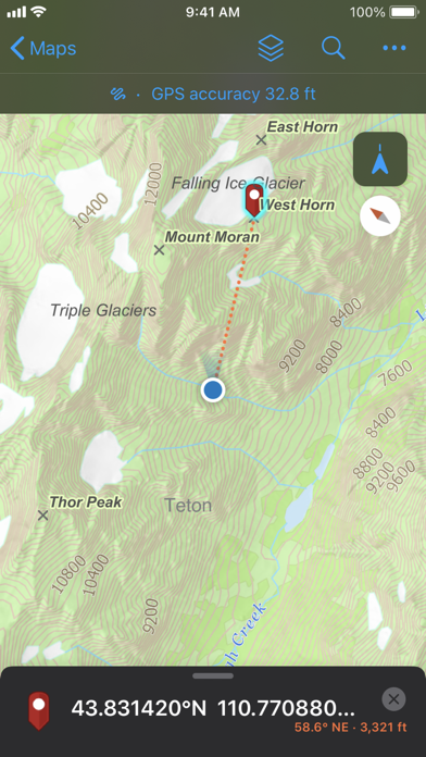
ArcGIS 可在您的桌面和瀏覽器取得,現在還可在 iPhone 或 iPad 上取得。ArcGIS Field Maps是 Esri 在行動裝置上主要的地圖應用程式。 使用Field Maps來探索您在 ArcGIS 中製作的地圖、收集和更新您的權威資料,以及記錄您去過的地方,這些動作皆可在單一可識別位置的應用程式中完成。
關鍵功能:
- 檢視使用 ArcGIS 所建立的高品質地圖。
- 將地圖下載到您的裝置和實現離線工作。
- 搜尋圖徵、座標和地點。
- 採集點、線、區域和相關資料。
- 標記地圖供您自己使用,或與其他人分享。
- 使用專業級 GPS 接收器。
- 使用地圖或 GPS(即使是在背景進行)採集和更新資料。
- 填寫容易使用的地圖導向智慧表單。
- 將照片和影片附加到您的圖徵。
- 記錄您去過的地方並分享您的位置。
- 藉由整合裝置的其他應用程式以順暢地執行現場工作流程。
附註:此應用程式要求您必須擁有 ArcGIS 組織帳號才能收集和更新資料。
注意:持續在背景中執行 GPS 可能會大幅縮短電池壽命。
Show More
最新版本24.1.1更新日誌
Last updated on 2024年04月02日
歷史版本
- 各種錯誤修正和增強功能。
Show More
Version History
24.1.1
2024年04月02日
- 各種錯誤修正和增強功能。
24.1.0
2024年02月29日
- 在表格上顯示唯讀文字。
- 停用標記工具。
- 各種錯誤修正和增強功能。
- 停用標記工具。
- 各種錯誤修正和增強功能。
24.0.1
2024年01月11日
- 各種錯誤修正和增強功能。
23.3.0
2023年10月25日
- 各種錯誤修正和增強功能。
23.2.3
2023年08月07日
- 各種錯誤修正和增強功能。
23.2.2
2023年06月29日
- 各種錯誤修正和增強功能。
23.2.1
2023年06月26日
- 各種錯誤修正和增強功能。
23.2.0
2023年06月14日
- 支援使用自訂 Arcade 表達式建立的地理圍欄。
- 未達到 GPS 修復類型閾值時發出警告。
- 封鎖手動收集或在使用時發出警告。
- 各種錯誤修正和增強功能。
- 未達到 GPS 修復類型閾值時發出警告。
- 封鎖手動收集或在使用時發出警告。
- 各種錯誤修正和增強功能。
23.1.0
2023年02月22日
- 使用圖磚套件項目來最佳化離線地圖區域。
- 使用應用程式連結更新前次的已知位置頻率。
- 使用 MDM 或應用程式連結,僅分享前次的已知位置。
- 搭配使用智慧卡與 iOS 登入 16.
- 各種錯誤修正和增強功能。
- 使用應用程式連結更新前次的已知位置頻率。
- 使用 MDM 或應用程式連結,僅分享前次的已知位置。
- 搭配使用智慧卡與 iOS 登入 16.
- 各種錯誤修正和增強功能。
22.4.2
2022年12月19日
- 各種錯誤修正和增強功能。
22.4.1
2022年12月07日
- 各種錯誤修正和增強功能。
22.4.0
2022年11月10日
- 編輯樓層感知圖層。
- 增強快顯支援。
- 存取下載地圖的線上版本。
- 將 IPS 使用於位置分享和地理圍欄。
- 支援點和線地理圍欄。
- 使用圖層篩選器篩選圖徵。
- 各種錯誤修正和增強功能。
- 增強快顯支援。
- 存取下載地圖的線上版本。
- 將 IPS 使用於位置分享和地理圍欄。
- 支援點和線地理圍欄。
- 使用圖層篩選器篩選圖徵。
- 各種錯誤修正和增強功能。
22.3.1
2022年08月24日
- 各種錯誤修正和增強功能。
22.3.0
2022年06月23日
- 使用公用事業網路。
- 使用室內定位。
- 根據您的位置接收警示。
- 觸發與地理圍欄的位置分享。
- 擷取線條和多邊形的 GPS 中繼資料。
- 改善意外值支援。
- 各種錯誤修正和增強功能。
- 使用室內定位。
- 根據您的位置接收警示。
- 觸發與地理圍欄的位置分享。
- 擷取線條和多邊形的 GPS 中繼資料。
- 改善意外值支援。
- 各種錯誤修正和增強功能。
22.2.1
2022年05月31日
- 各種錯誤修正和增強功能。
22.2.0
2022年05月03日
- 藉著條件值來簡化資料收集。
- 各種錯誤修正和增強功能。
- 各種錯誤修正和增強功能。
22.1.0
2022年03月28日
- 支援表格計算。
- 使用 MDM 設定簡化高精度部署。
- 各種錯誤修正和增強功能。
- 使用 MDM 設定簡化高精度部署。
- 各種錯誤修正和增強功能。
21.4.0
2021年12月15日
- 在收集期間存取最近使用的樣板。
- 改進了測量線和區域時的體驗。
- 支援 Trimble DA2 GNSS 接收器。
- 各種錯誤修正和增強功能。
- 改進了測量線和區域時的體驗。
- 支援 Trimble DA2 GNSS 接收器。
- 各種錯誤修正和增強功能。
21.3.1
2021年10月07日
- 各種錯誤修正和增強功能。
21.3.0
2021年09月22日
- 各種錯誤修正和增強功能。
21.2.3
2021年08月30日
- 各種錯誤修正和增強功能。
21.2.2
2021年07月26日
- 各種錯誤修正和增強功能。
21.2.1
2021年07月13日
- 各種錯誤修正和增強功能。
21.2.0
2021年06月30日
- 支援使用參數輸入資料。
- 複製圖徵的形狀和屬性來改善集合效率。
- 刪除線或多邊形中所有現有點。
- 支援刪除相片大小和相關類型。
- 各種錯誤修正和增強功能。
- 複製圖徵的形狀和屬性來改善集合效率。
- 刪除線或多邊形中所有現有點。
- 支援刪除相片大小和相關類型。
- 各種錯誤修正和增強功能。
21.1.1
2021年04月23日
- 各種錯誤修正和增強功能。
ArcGIS Field Maps FAQ
點擊此處瞭解如何在受限國家或地區下載ArcGIS Field Maps。
以下為ArcGIS Field Maps的最低配置要求。
iPhone
須使用 iOS 14.5 或以上版本。
iPad
須使用 iPadOS 14.5 或以上版本。
Apple Watch
須使用 watchOS 6.0 或以上版本。
iPod touch
須使用 iOS 14.5 或以上版本。
ArcGIS Field Maps支持丹麥文, 俄文, 克羅地亞文, 加泰羅尼亞文, 匈牙利文, 印尼文, 土耳其文, 巴克摩挪威文, 希伯來文, 希臘文, 德文, 意大利文, 捷克文, 斯洛伐克文, 日文, 法文, 波蘭文, 泰文, 烏克蘭文, 瑞典文, 簡體中文, 繁體中文, 羅馬尼亞文, 芬蘭文, 英文, 荷蘭文, 葡萄牙文, 西班牙文, 越南文, 阿拉伯文, 韓文


