Bikepacking Guides

Bikepacking Guides


Free

9.3.3for iPhone, iPad
Age Rating
4+
Apps in this category do not contain restricted content.
9+
Apps in this category may contain mild or occasional cartoon, fantasy or real-life violence, as well as occasional or mild adult, sexually suggestive or horrifying content and may not be suitable for children under 9 years of age.
12+
Apps in this category may contain occasional mild indecent language, frequent or intense cartoon or real-life violence, minor or occasional adult or sexually suggestive material, and simulated gambling, and may be for children under 12 years of age.
17+
You must be at least 17 years old to access this App.
Apps in this category may contain frequent and intense offensive language; Frequent and intense cartoon, fantasy or realistic violence: frequent and intense adult, scary and sexually suggestive subjects: as well as sexual content, nudity, tobacco, alcohol and drugs, may not be suitable for children under 17 years of age.
Bikepacking Guides Screenshots
Bikepacking Guides posterBikepacking Guides posterBikepacking Guides posterBikepacking Guides posterBikepacking Guides poster

About Bikepacking Guides

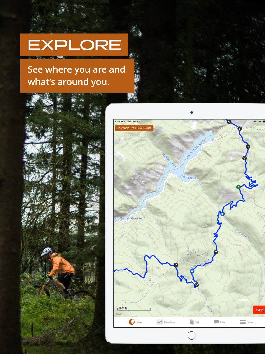
Bikepacking Guides is Atlas Guides' new sister bikepacking app to our proven and popular Guthook Guides hiking & backpacking app. You'll feel assured that you're on the right track with real-time location on a GPS-enabled map and highly-detailed guides showing you what's ahead. Our bikepacking guides include:

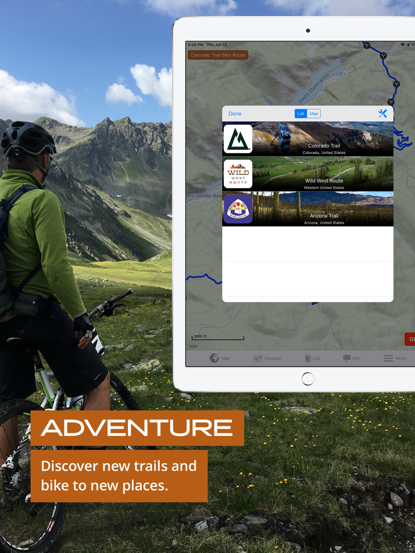
Wild West Route (official guide of Bikepacking Roots)
Arizona Trail Bike Route (official guide of Arizona Trail Association)
The Colorado Trail Bike Route (official guide of The Colorado Trail Foundation)

Key features:
—Detailed offline maps including GPS location, detailed routes, and waypoints
—Elevation profile view with GPS and key features
—Custom route creator to plan your trip
—Background map choices
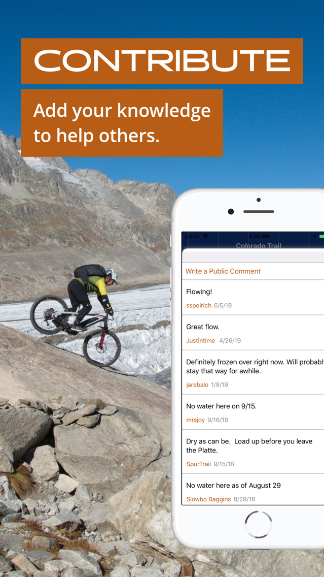
Waypoint data:
—Waypoints are plotted on the main trail and side trails
—Water sources, camp sites, road crossings, trailheads, junctions, viewpoints, passes, and much more
—Town details including accommodation, restaurants, and other services
Show More

What's New in the Latest Version 9.3.3

Last updated on Nov 25, 2020
Old Versions
9.3.3: A few more bug fixes for handling links from our email newsletter.

Let us know if you have any trouble by emailing us at support@atlasguides.com
Show More
Version History
9.3.3
Nov 25, 2020
9.3.3: A few more bug fixes for handling links from our email newsletter.

Let us know if you have any trouble by emailing us at support@atlasguides.com
8.1.10
Oct 31, 2019
v8.1.10:

Building off our last update, we fixed a few more small bugs. Thanks for your feedback, and stay tuned for big updates in the coming months!

Let us know if you have any trouble by emailing us at support@atlasguides.com
8.1.9
Oct 24, 2019
v8.1.9:

More bug fixes, and some updates to our guide views.
-We've fixed some of the tools in your User Account view, so all buttons now work. You can get to lists of all your routes, comments, recorded tracks, and custom waypoints from your User Account view.
-The main menu is split up a little to organize things better. The main menu is still there, but there's also a tools button in the map and elevation for quick tools like routes and custom waypoints.
-As always, we've been working on plenty of bug fixes to make sure everything keeps working better and better.

Let us know if you have any trouble by emailing us at support@atlasguides.com
8.1.8
Aug 9, 2019

Bikepacking Guides FAQ

Click here to learn how to download Bikepacking Guides in restricted country or region.
Check the following list to see the minimum requirements of Bikepacking Guides.
iPhone
iPad
Bikepacking Guides supports English

Bikepacking Guides Alternative

You May Also Like

Get more from Atlas Guides LLC