◆ Length annotations can now show line direction as azimuth or U.S. land survey bearing. Settings > Map Settings > Common settings > Annotations > Angle.
◆ Ground Image Overlays: Added limited support for kml gx:LatLonQuad overlays (including export).
◆ Google maps updated to version 6.2.1.
◆ Amazing new feature in this version: Ground Image Overlays!
• The app can import image overlays from kmz (GroundOverlay).
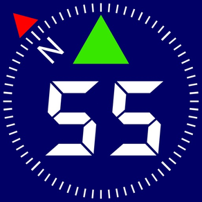
• You can also take map snapshots in the app (use the button with the compass for this) and save them as image overlays.
• You can draw on top of the image overlays to turn them into tactical plans or add fast freehand annotations.
• Image overlays can be exported as kmz files to open in any compatible app or Google Earth.
◆ You can now order point collections manually and newest collections are shown on top by default. MENU > WAYPOINT COLLECTIONS > Edit.
◆ Import of a photo from the photo library for the waypoint now correctly imports .heic photos.
◆ Google maps updated to version 6.0.1.
◆ Tracks list screen now includes small map previews for the tracks. You can opt out of generating map previews in GPS Tracking settings.
◆ In addition to month-year filtering, you can now filter tracks by the year.
◆ Improved import for big KML/KMZ files/objects.
・Optimized for iOS 15.
・Google maps updated to version 5.1.0.
・Added help for individual counters reset in the trip editor.
・MENU > TRIPS: Menu button now shows the active trip name.
◆ MENU > NEW TRACK:
・Menu button now shows current tracking settings and includes a settings button to change these settings.
◆ MENU > WAYPOINT COLLECTIONS:
・Shows the default collection name.
◆ Changes to GPS tracking workflow:
・You can now change the active trip while tracking. The app will ask if you want to create a new track under the newly active trip.
◆ Point collections:
・MENU > POINT COLLECTIONS. Tap on a collection row now shows collection action menu.
・The above mentioned menu adds option to clone the whole collection.
◆ Camera, photo and audio attachments:
・Added option to pick the camera device/type for iPhones/iPads with multiple cameras.
・Manual exposure adjustment now uses target exposure bias. This should correspond to how exposure adjustment works in the stock camera app.
◆ Other improvements and fixes:
・Triangle map cursor is now bigger and has white border added.
◆ Removed support for iOS 9-11.
◆Optimized for iOS 14.5.
◆Import/Export:
・The app should now always be offered as 'Open In' option for GPX files.
・Tracks (gx:track and Geometry) can now be imported from KMZ files (only one kml file is supported inside the kmz archive, but it may contain multiple tracks).
・Added GPX export option for the whole trip export (with all tracks). Please note that empty tracks are not exported as Garmin Connect can't import empty tracks anyway. GPX export also generates quite bigger files, compared to KMZ.
・New option to convert route point collection to a track.
◆Point editor:
・Note text field is moved to its own section at the bottom of a point editor screen.
・Point notes now support multiple lines.
・Fixed the bug in point editor when subsequent record/play sessions would play the first recording played, not the most recently recorded audio note.
◆Offline and custom maps:
・Fixed crash when selecting offline map area in iOS 9.
・Refreshed Custom map source editor screen.
◆Voice coach:
・Fixed an issue when new voice coach can't be added after deleting all existing voice coaches.
◆Camera, photo and audio attachments:
・Using downscaled image thumbnails where image previews are shown, e.g. in the points list.
◆Other improvements and fixes:
・New Maintenance screen in the settings allows to delete temporary files in the app.
・All import/export and sharing operations were reviewed to only create temporary files in the system's temporary folder that is being cleaned by iOS automatically after some period of time.
Fixed the issue when route and target lines would not be shown on the offline maps for iOS 14.
・ Optimized for iOS 14.
・ Updated airplane map pointer.
・ Added helicopter map pointer.
・ Bug fixes and optimizations.
• Camera tool: Photo file names correspond to photo titles for import to PC/Mac with SynciOS app and for AirDrop transfer from iPhone/iPad photo library to Mac.
• Waypoints: new export option for CSV with all fields from photos and points.
• Bug fixes and optimizations.
・ Bug fixes and optimizations:
‣ Optimized for iOS 13.6.
‣ Fixes for users that are using 12 hours (AM/PM) time format.
・ Bug fixes and optimizations:
‣ Fixed visibility of place and address search for the dark mode.
‣ Optimized handling of speed and distance for low GPS accuracy.
Pro Pack only:
・ Google maps updated to version 3.9.0.
・ Option to set activity type to further optimize GPS tracking accuracy: Automotive, Fitness, Airborne, Other (boat, train). Settings > GPS Tracking > Activity type.
・ More optimizations for iOS 13.5 (better handling for low speed and accuracy cases).
・ Personal GPS Locator Beacon:
- Option to create your personal GPS Beacon and provide your loved ones with a web link to follow your location in a web browser.
- Your location breadcrumb is only sent to your personal GPS beacon when it is enabled and you record a track.
- You can protect access to your GPS Beacon web link with a password or disable access at any moment.
・ Optimized for iOS 13.5.
・ Bug fixes and optimizations.
Pro Pack only:
・ Personal GPS Locator Beacon:
- Option to create your personal GPS Beacon and provide your loved ones with a web link to follow your location in a web browser.
- Your location breadcrumb is only sent to your personal GPS beacon when it is enabled and you record a track.
- You can protect access to your GPS Beacon web link with a password or disable access at any moment.
・ Newest Google maps with lower memory and CPU consumption.
・ Optimized for iOS 13.4.
・ Option to order points list by the date of creation (descending), instead of a date of the last update. (MENU > Waypoints > Tap on a filter).
・ Added a confirmation popup before deleting multiple selected points in points list.
・ Showing magnetic declination with a decimal point accuracy.
Pro Pack only:
・ Option to show route and polygon connection points as small dots (Map Settings > Common settings > Annotations).
・ Option to setup zone (enter/leave) alerts for the polygonal areas.
・ Better track points approximation for the Google map.
・ Better import of GPX tracks, especially from drones where speed is often present inside the trkpt element.
・ Point collection editor is not capitalizing every word in the collection name anymore.
・ Bug fixes and optimizations.
+ Please, everyone stay safe!
・ Optimized for iOS 13.2+.
Pro Pack only:
・ You can now customize upper screen corners (left and right). Look for ⋮ buttons and tap on them to see the options. Options for the main screen and map corners are independent on each other. Different corner panels can be shown when map follows your location or when you browse/move the map.
+ A few options are provided for these new corners, please let us know via Feedback what else you'd like to add.
More fixes and optimizations for iOS 13.0-13.2:
Fixing a very rare crash in the app in iOS 13 when using offline maps. Huge thanks to Roman for reporting this (a very hard to reproduce one!) and helping with testing the fix.
More optimisations and fixes for iOS 13(1.3).
Fixed GPX export for waypoints (Huge thanks to Robert for reporting the problem).
・Optimized for iOS 13.
・Night mode for the Apple map (needs iOS 13 and higher). This is not controlled by iPhone's dark or light mode - you control map appearance in the settings just as it is done for the Google map.
・Supporting iPhone's dark mode by showing darker popups/dialogs when in the dark mode.
・ Diagnose and solve GPS issues with a GPS troubleshooting screen (MENU > Feedback & Support > GPS troubleshooting)
・ Improved handling of weak/strong GPS accuracy for iOS 13.
・Adding 'Pin to live map' to track row swipe options.
・Avoiding deletion of a track/trip row on a long swipe (needs iOS 11 and higher).
・Newest Google maps with lower memory and CPU consumption.
Reworked feedback & support screen.
Bug fixes and optimisations:
- Returning back tracks/trips filter. Huge thanks to Eric for spotting the problem!
・Circular regions - measure + setup alerts for entering or leaving.
・Color options for the course line: auto, always black or white. That's part of preparations for the iOS 13 dark mode support.
・New bottom panel option for paragliders: BARO VSI + Compass.
・Improvements for kml/kmz import and export.
We would be honored if you find a minute to support the app with your kind review or rating!
New options for images and photos:
・Camera button inside a NEW WAYPOINT menu item allows to take photos overlayed with location, date and notes.
・Waypoint images can be stamped with location, date, note, shared separately or saved into photo library.
・'Select All' option when selecting multiple waypoints.
・Tap on a waypoint on a map will show a small image preview if waypoint has an image attached. Tap on an image to open its full screen preview with options to annotate and add notes.
We would be honored if you find a minute to support the app with your kind review or rating!
・Optimized for iOS 12.・(PRO) Siri shortcuts: New Track, Stop Track.
・Barometric vertical speed indicator.・Magnetic declination for the current location and any point on the map.
・(PRO) Voice coach. When enabled and configured, voice coach will be telling you active track distance and duration as well as current speed and altitude.
・Added privacy policy. Available via MENU > FEEDBACK & SUPPORT.
We would be honored if you find a minute to support the app with your kind review or rating!
This version adds more polish on automatic canceling of map centering. Common map settings screen now gives options to cancel centering automatically or not, as well as adds option to return automatically to the centering mode when you stop moving the map.
+ Fixing rare crash conditions.
+ Fixing crash when telling distance left to a target in French language.
This new version should answer your feedback on map returning back to your current location. Previously, you had to do some taps to switch between the centering and non-centering modes. Now you just move the map and the app cancels the centering mode, showing RE-CENTER button on top. Tap on RE-CENTER button to return back to map following your location. In addition to this, fixing some minor/rare map layout issues for iPads. Yours and thankful for your feedback and ideas! Stan, the dev.
・Compass on all maps. Tiny, but hopefully useful.
・In map search/browse mode, tap on a waypoint for a new option - Move.
・Waypoints screen allows for selection of multiple points to delete (and export/share in pro).
-- Pro Pack only --
・Option to use Google map in all places where map is shown (Track view, point editor).
・Export for a single waypoint.
・Kmz import/export for waypoints allows to keep all app specific data (photo and audio) when transferring between devices.
We would be honored if you find a minute to support the app with your kind review or rating!