Explore Kawachinagano

Explore Kawachinagano


Free

1.0for iPhone, iPad
Stroly Inc.
Developer
Apr 13, 2016
Update Date
Travel
Category
Age Rating
4+
Apps in this category do not contain restricted content.
9+
Apps in this category may contain mild or occasional cartoon, fantasy or real-life violence, as well as occasional or mild adult, sexually suggestive or horrifying content and may not be suitable for children under 9 years of age.
12+
Apps in this category may contain occasional mild indecent language, frequent or intense cartoon or real-life violence, minor or occasional adult or sexually suggestive material, and simulated gambling, and may be for children under 12 years of age.
17+
You must be at least 17 years old to access this App.
Apps in this category may contain frequent and intense offensive language; Frequent and intense cartoon, fantasy or realistic violence: frequent and intense adult, scary and sexually suggestive subjects: as well as sexual content, nudity, tobacco, alcohol and drugs, may not be suitable for children under 17 years of age.
Explore Kawachinagano Screenshots
Explore Kawachinagano posterExplore Kawachinagano posterExplore Kawachinagano posterExplore Kawachinagano posterExplore Kawachinagano poster

About Explore Kawachinagano

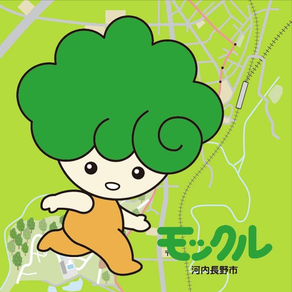
「河内長野さんぽ」は、かわいいイラストマップの中に、現在地として、河内長野市シンボルキャラクターの「モックル」が表示されるアプリです。「モックル」とともに、河内長野の自然や歴史を巡ることができます。

【掲 載 地 図 数】 17枚
- テクルートまっぷ“西高野街道コース”(日本語)
- テクルートまっぷ“歴史と花コース”(日本語)
- テクルートまっぷ“やまびこコース”(日本語)
- Walking Route Map “West Koya Highway Course” (English)
- Walking Route Map “History and Flowers Course” (English)
- Walking Route Map “Nature Course” (English)
- 参拜路线地图“西高野街道路线”(簡体中文)
- 参拜路线地图“历史和花路线”(簡体中文)
- 参拜路线地图“回声路线”(簡体中文)
- 參拜路線地圖“西高野街道路線”(繁体中文)
- 參拜路線地圖“歷史和花路線”(繁体中文)
- 參拜路線地圖“回聲路線”(繁体中文)
- 도보여행 지도“니시코우야가이도 코스”(한국어)
- 도보여행 지도“역사와 꽃 코스”(한국어)
- 도보여행 지도“야마비코 코스”(한국어)
- 河内長野市バスマップ(日本語)
- BUS ROUTES MAP in Kawachinagano City (English)

■アプリ特徴
* イラスト地図とGPS情報を対応づけており、地図上に現在地を表示します。
* GPS情報に基づき現在地が移動し地図の上を歩いているような感覚を味わえます。
* 地図上のランドマークアイコンには付近のおすすめスポット情報が入っています。
* 地図と標準地図との表示を切り替えることができます。

■お断り
1. GPS機能を使用するアプリケーションであるため、iPod TouchやiPad Wi-Fiモデルでのご使用の場合は、現在地の表示精度がよくない場合があります。
2. 当アプリで使用しております地図は、入手時の状態から加工・修正しておりません。
3. 地図原画が本来持つ歪みやGPS精度により、位置情報の表示については100%の精度を保証するものではありません。イラストマップや古地図の微妙な不確実性も味わいの一つとしてお楽しみ下さい。
4. 本ソフトウェアは、弊社(株式会社ATR Creative)、河内長野市観光協会が共同で提供するサービスです。
私たちは、人権を尊重いたします。地図等の公開により人権を侵害することは、私たちの意図するところではありません。
Show More

What's New in the Latest Version 1.0

Last updated on Apr 13, 2016
Old Versions
This app has been updated by Apple to use the latest Apple signing certificate.
Show More
Version History
1.0
Apr 13, 2016
This app has been updated by Apple to use the latest Apple signing certificate.

Explore Kawachinagano FAQ

Click here to learn how to download Explore Kawachinagano in restricted country or region.
Check the following list to see the minimum requirements of Explore Kawachinagano.
iPhone
iPad
Explore Kawachinagano supports English, Japanese

Explore Kawachinagano Alternative

You May Also Like

Get more from Stroly Inc.