Kartenentfernungsrechner
Flächen mit GPS vermessen
GratisOffers In-App Purchases
4.5.3for iPhone, iPad and more
Age Rating
Kartenentfernungsrechner Screenshots
About Kartenentfernungsrechner
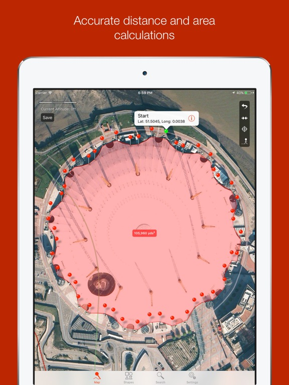
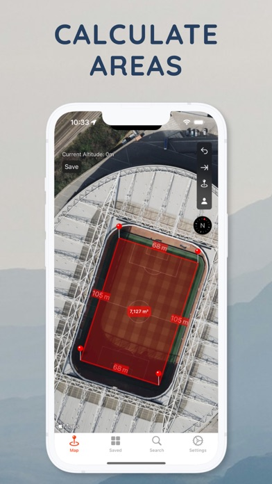
Distance Tool allows for quick and easy calculations to find distances between points on a map, including area calculations for non-overlapping polygons drawn. Includes metric (meters, kilometers) and imperial units (yards, miles, feet for altitude) for distances. Co-ordinates can either be displayed in decimal or degrees, meters and seconds.
Useful for mapping fields in agriculture, plots of land/home boundaries, or for general interest in distances and areas!
Functionality to drop a point at your current location (GPS or otherwise), and to email the results. Tap briefly to drop points anywhere on the map.
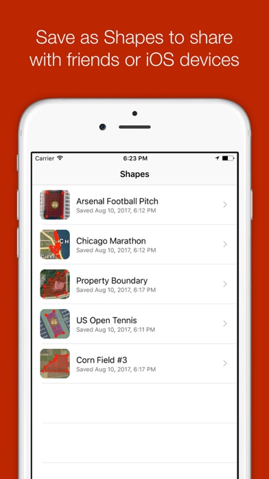
Share your drawing (shape) by email, which includes a file that can be opened on any device with Distance Tool.
Allows the standard map views of standard, satellite and hybrid.
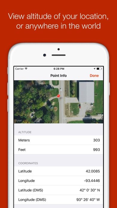
Supports quick altitude calculation without data connectivity. Find out how high up you are! Or see the altitude of ANY point (requires data).
Freehand draw: Draw any shape on the map to quickly calculate area.
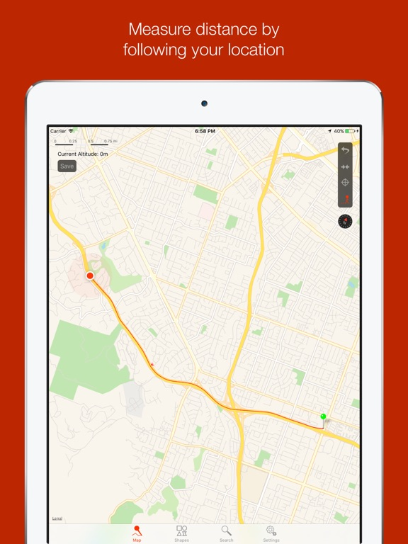
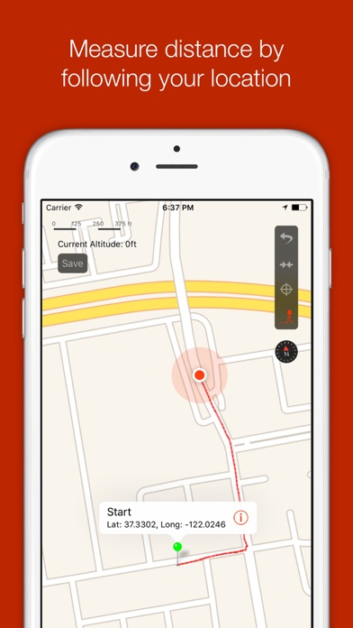
Follow Mode: Calculate distance or areas simply by moving!
Subscription terms:
- The subscription auto-renews at the end of each term.
- Payment will be charged to iTunes Account at confirmation of purchase.
- The subscription automatically renews unless auto-renew is turned off at least 24-hours before the end of the current period.
- Account will be charged for renewal within 24-hours prior to the end of the current period.
- You may manage your subscription and turn off auto-renewal by going to your Account Settings after purchase.
Privacy policy and Terms of Use: https://applorium.com/privacy-distance-tool
Show More
Was ist neu in der neuesten Version 4.5.3
Last updated on Mar 19, 2024
Alte Versionen
Bug fixes & improvements
Show More
Version History
4.5.3
Mar 19, 2024
Bug fixes & improvements
4.5.2
Nov 3, 2023
Bug fixes & improvements
4.5.1
Aug 15, 2023
Bug fixes and improvements
4.5.0
Aug 15, 2023
Added duration and price estimations
4.4.0
May 25, 2023
- Fresh new icon
- You can now export images of the maps & GPX files
- You can now export images of the maps & GPX files
4.3.1
May 20, 2023
Bug fixes and improvements
4.3
May 18, 2023
- Added distance labels between every pin
- Calculate distance & area
- Calculate distance & area
4.2
Mar 13, 2021
Minor bug fixes
4.1
Jan 23, 2021
Minor bug fixes
4.0
Sep 29, 2019
iOS13 support
3.2
Sep 20, 2017
Ability to move a pin
Ability to delete any pin from the Point Info screen
Use MGRS and UTM/UPS for co-ordinates (and in Point Info screen)
Use different units for distances and areas
Nautical Miles, Feet, Acres, Hectares
Fixed a bug where editing a Shape would create a duplicate
Fixed a bug where cancelling edit Shape changes would not work
Fixed a bug when editing a saved Shape in the map view would auto save the changes to the Shape
3.1
Aug 17, 2017
Included support for iOS9 for older devices
Fixes a crash on iPad when sharing a Shape
Fixes a crash on iPad when sharing a Shape
3.0
Aug 16, 2017
iOS8+ UI refresh
Adverts removed for everyone
New icon
Flashlight/torch removed
Search accuracy improved
Initial zoom level set closer to user
Point Information includes nearby places
Rotation support
Adverts removed for everyone
New icon
Flashlight/torch removed
Search accuracy improved
Initial zoom level set closer to user
Point Information includes nearby places
Rotation support
2.2
Oct 4, 2012
- iPhone 5 support
2.1
Sep 4, 2012
- Fixes an issue where Settings would crash on some devices.
2.0
Aug 28, 2012
- iPad compatibility
- Improved search
- New "Share" functionality: Generate a web link of your data set (called a shape), or email, or both.
- Email now includes a shape file that can be opened on any device with Distance Tool
- "Go to My Location" button removed as unnecessary, can get to location from pressing the "tag" button and removing the pin if required
- Fixed an issue with pins displaying the incorrect colour
- (Paid upgrade) Enable saving/loading of "shapes" - sets of data
- (Paid upgrade) Freehand draw without straight lines!
- Adverts removed for paid upgrade
1.4
Aug 1, 2012
- (NEW!) Altitude at point, and further point information
- (NEW!) Degrees, Minutes, Seconds support for co-ordinates
- Altitude shown on screen and updates constantly, instead of as an alert
- A torch off button is now shown on the screen, instead of having to open the More menu to turn off
- Settings has been entirely revamped, including additional functions (feedback, rate, etc).
- Distance Tool will prompt for a user rating after several uses
- iOS 6 preparation
1.3
Mar 1, 2012
- Dropped pins automatically show their bubble
- Copyright updated
- Copyright updated
1.2
Feb 16, 2012
- Added a flashlight/torch (depending on device support)
- Added a tutorial on first launch (accessible through Settings)
- Added a tutorial on first launch (accessible through Settings)
1.1
Jan 10, 2012
- Added My Altitude button under the more tab. Allows for quick calculation of your current altitude (in both metric or imperial units), with no data connectivity required.
- My Location changed to "Go to My Location". Always centres your current location at the current zoom level.
- Status bar style updated.
- About updated.
- My Location changed to "Go to My Location". Always centres your current location at the current zoom level.
- Status bar style updated.
- About updated.
1.0
Nov 11, 2011
Kartenentfernungsrechner FAQ
Klicken Sie hier, um zu erfahren, wie Sie Kartenentfernungsrechner in eingeschränkten Ländern oder Regionen herunterladen können.
Überprüfen Sie die folgende Liste, um die Mindestanforderungen von Kartenentfernungsrechner zu sehen.
iPhone
Erfordert iOS 13.0 oder neuer.
iPad
Erfordert iPadOS 13.0 oder neuer.
Mac
Erfordert macOS 10.15 oder neuer.
iPod touch
Erfordert iOS 13.0 oder neuer.
Kartenentfernungsrechner unterstützt Deutsch, Englisch, Finnisch, Französisch, Portugiesisch, Spanisch
Kartenentfernungsrechner beinhaltet In-App-Käufe. Bitte überprüfen Sie den folgenden Preisplan:
Premium - freehand & follow
8,99 €
Distance Calculator Premium
22,99 €
Distance Calculator Monthly
3,99 €
Distance Tool Lifetime
44,99 €

