◆ Optimized for iOS 17.
◆ Removed support for iOS 12-14. Supported iOS versions are now 15, 16, 17. You can still install older app versions on the devices with older iOS versions.
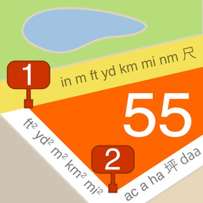
◆ Overzoom and underzoom for offline maps:
‣ Allows to show the offline map for zoom levels that are not downloaded or imported.
‣ With overzoom you can download zoom level 2-16 and let the map upscale from zoom level 16 to 17-19 as you zoom in.
‣ Overzoom and underzoom is applied automatically, no need to set up anything.
‣ For the best experience with offline or custom/blank maps on iOS 16, please be sure to have iOS 16.4 or later.
◆ Camera tool:
‣ You can now re-apply comments from existing points/photos to fill all manual comment fields for the new photo, at once. Should give a productivity boost for re-inspections. It's a new bottom section in the comments editor screen.
‣ Removed full swipe delete gesture in the list of photos as it was causing unwanted deletes. Thank you for the feedback! You can still delete by swipe, but need to swipe and then tap on the delete button.
‣ Now you can configure the automatic photo title that goes far beyond the timestamp. Combine collection name, timestamp, custom text and auto increment number in any way that suits best your work or project. Timestamp still stays as a default automatic photo title.
‣ When viewing saved photos, the app now remembers if your last view choice was the original photo or stamped. No need to switch to the stamped view everytime, your preference is now remembered.
‣ When you open photo from the points list, the app now provides controls to navigate through the adjacent photos in the points list, without the need to return to the list. You can swipe through or use left/right arrows.
1. Overzoom and underzoom for offline maps:
‣ Allows to show the offline map for zoom levels that are not downloaded or imported.
‣ With overzoom you can download zoom level 2-16 and let the map upscale from zoom level 16 to 17-19 as you zoom in.
‣ Overzoom and underzoom is applied automatically, no need to set up anything.
‣ For the best experience with offline or custom/blank maps on iOS 16, please be sure to have iOS 16.4 or later.
2. Camera tool:
‣ You can now re-apply comments from existing points/photos to fill all manual comment fields for the new photo, at once. Should give a productivity boost for re-inspections. It's a new bottom section in the comments editor screen.
‣ Removed full swipe delete gesture in the list of photos as it was causing unwanted deletes. Thank you for the feedback! You can still delete by swipe, but need to swipe and then tap on the delete button.
◆ Optimized for iOS 16.:
• Paste buttons are changed to the new iOS 16 paste buttons that don't ask for a permission every time you need to paste.
• Compiled and tested under iOS 16 SDK.
◆ Length annotations can now show line direction as azimuth or U.S. land survey bearing. Settings > Annotations > Angle.
◆ Google maps updated to version 6.2.1.
◆ Amazing new feature in this version: Ground Image Overlays!
• The app can import image overlays from kmz (GroundOverlay).
• You can also take map snapshots in the app (use the button with the compass for this) and save them as image overlays.
• You can draw on top of the image overlays to turn them into tactical plans or add fast freehand annotations.
• Image overlays can be exported as kmz files to open in any compatible app or Google Earth.
◆ You can now order point collections manually and newest collections are shown on top by default. MENU > POINT COLLECTIONS > Edit.
◆ You can now sort point collections by name or date of creation. MENU > POINT COLLECTIONS > Bottom-right sort button.
・Improved import for big KML/KMZ files/objects.
・Import of a photo from the photo library for the point now correctly imports .heic photos.
・Google maps updated to version 5.2.0.
・Optimized for iOS 15.
・Google maps updated to version 5.1.0.
Camera:
・Improved speed of a camera start and switching between cameras, especially for older devices.
・Fixed the issue with low quality front camera preset still producing the full quality photos.
・Fixed the app crash when switching on iPhone 6 (iOS 12) from back to front camera with the medium quality preset.
◆ Point collections:
・MENU > POINT COLLECTIONS. Tap on a collection row now shows collection action menu.
・The above mentioned menu adds option to clone the whole collection.
◆ Camera, photo and audio attachments:
・Added option to pick the camera device/type for iPhones/iPads with multiple cameras.
・Manual exposure adjustment now uses target exposure bias. This should correspond to how exposure adjustment works in the stock camera app.
◆ Other improvements and fixes:
・Triangle map cursor is now bigger and has white border added.
◆ Removed support for iOS 9-11.
◆Optimized for iOS 14.5.
!! This is probably the last release supporting iOS 9-11. Main focus of this version is to leave iOS 9-11 users with version that hopefully keeps working very well on their older devices for the years to come.
◆Import/Export:
・The app should now always be offered as 'Open In' option for GPX files.
◆Point editor:
・Note text field is moved to its own section at the bottom of a point editor screen.
・Point notes now support multiple lines.
・Fixed the bug in point editor when subsequent record/play sessions would play the first recording played, not the most recently recorded audio note.
◆Offline and custom maps:
・Fixed crash when selecting offline map area in iOS 9.
・Refreshed Custom map source editor screen.
◆Camera, photo and audio attachments:
・Using downscaled image thumbnails where image previews are shown, e.g. in the points list.
◆Other improvements and fixes:
・All import/export and sharing operations were reviewed to only create temporary files in the system's temporary folder that is being cleaned by iOS automatically after some period of time.
Fixed the issue when lines would not be shown on the offline maps for iOS 14.
• Camera tool: Photo file names correspond to photo titles for import to PC/Mac with SynciOS app and for AirDrop transfer from iPhone/iPad photo library to Mac.
• Waypoints: new export option for CSV with all fields from photos and points.
• Bug fixes and optimizations.
・ Optimized for iOS 13.4.
・ Option to order points list by the date of creation (descending), instead of a date of the last update. (MENU > Points > Tap on a filter).
・ Option to show route and polygon connection points as small dots..
+ Please, everyone stay safe!
Improved performance for iOS 13-13.2.
Fixed red-arrow pointer placement for the map section of a point editor screen.
Fixed red arrow position on a main map after rotation.
Improved performance for iOS 13-13.2.
Fixed red-arrow pointer placement for the map section of a point editor screen.
Fixed red arrow position on a main map after rotation.
More optimisations and fixes for iOS 13(1.3).
Fixed GPX export for waypoints (Huge thanks to Robert for reporting the problem).
・Optimized for iOS 13.
・Supporting iPhone's dark mode by showing darker popups/dialogs when in the dark mode.
・Circles - radius, perimeter and area measurement.
・Option to apply coordinates from clipboard in the point editor screen (Actions row > ≣).
・Improvements for kml/kmz import and export.
・Updated Google map version.
・Reworked feedback & support screen.
Bug fixes and optimisations.
Updated to the latest Google Maps SDK.
Improved KML/KMZ import.
New options for images and photos:
・New 'Camera' menu item allows to take photos overlayed with location, date and notes.
・Point images can be stamped with location, date, note, shared separately or saved into photo library.
・'Select All' option when selecting multiple points.
・Tap on a point on a map will show a small image preview if point has an image attached. Tap on an image to open its full screen preview with options to annotate and add notes.
We would be honored if you find a minute to support the app with your kind review or rating!
Optimized for iOS 12 and new iPhones. Using new, better fonts. Bug fixes and performance optimizations.
・Points screen allows for selection of multiple points to delete.
-- Pro Pack only --
・Points screen allows for selection of multiple points to export/share.
・Fixes for sharing and export.
------
We would be honored if you find a minute to support the app with your kind review or rating!