• New option to work with raster maps in MBTiles format.
• New ability to record and save voice comments (audio attachments) when creating and describing features on the map.
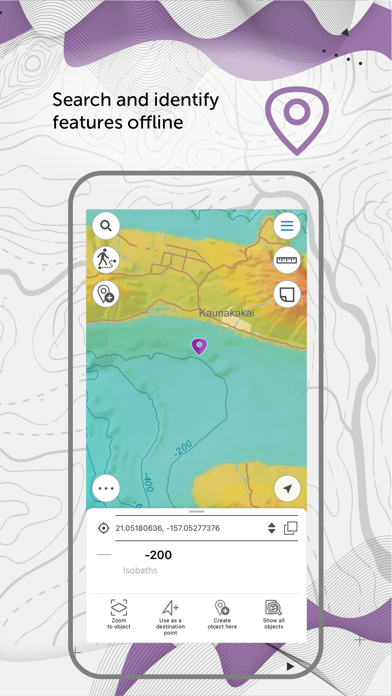
• New option to set and view Z coordinates of point features.
• New option to view information about traveled distance when moving to the destination point.
• Automatic creation of a point based on the user's location.
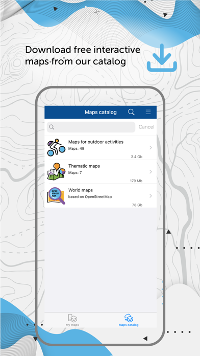
* Access to the data catalog is now available on the app start page.
* New option to determine the relative location on the map using circular ruler.
* New tool for measuring the geographical azimuth between points on the map.
* New tool for measuring the radius of a circle with the center at the selected point.
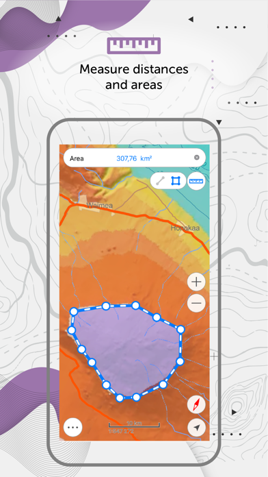
* New option to calculate the area of selected objects in hectares.
* Improved logic for saving the set of layers as the project.
• Access to the data catalog is now available on the app start page.
• New option to determine the relative location on the map using circular ruler.
• New tool for measuring the geographical azimuth between points on the map.
• New tool for measuring the radius of a circle with the center at the selected point.
• New option to calculate the area of selected objects in hectares.
• Improved logic for saving the set of layers as the project.
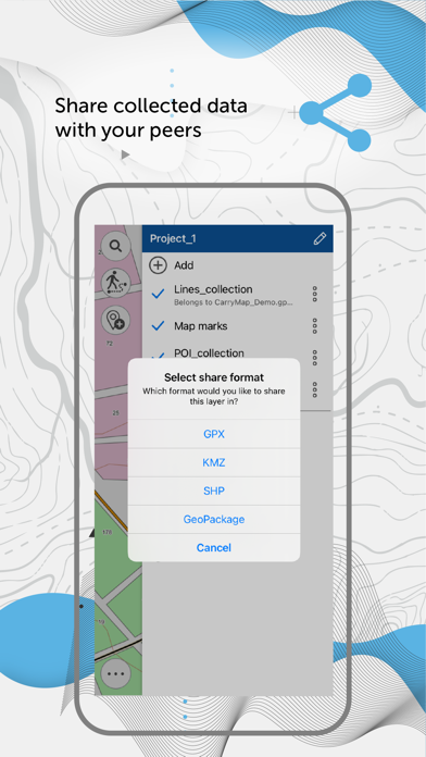
• Added ability to share a set of maps and data layers that are combined in a Project.
• Improved logic for creating graphic marks.
• Updated logic of feature identification in the map.
• Improved interface of feature identification card.
• Added localization to Kazakh.
• Minor fixes and enhancements.
• Added Spanish localization.
• Other fixes and enhancements.
Minor fixes and enhancements.
• Redesigned app interface.
• Updated options of features creation and editing.
• New option of downloading the GeoPackage layer symbology categories based on the unique feature values.
• Updated content of the map catalog.
• Other fixes and enhancements.
Added support for the new iPadOS 15 version
Fixed error with displaying maps and fonts
Fixed error with displaying data and maps
Updated interface in the mode of creating and editing objects
Create a point using the device camera
Add graphic marks to map
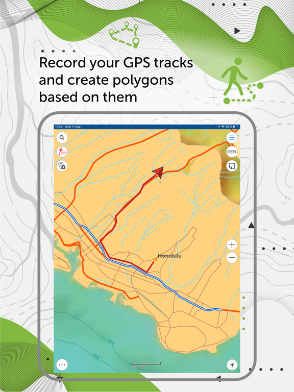
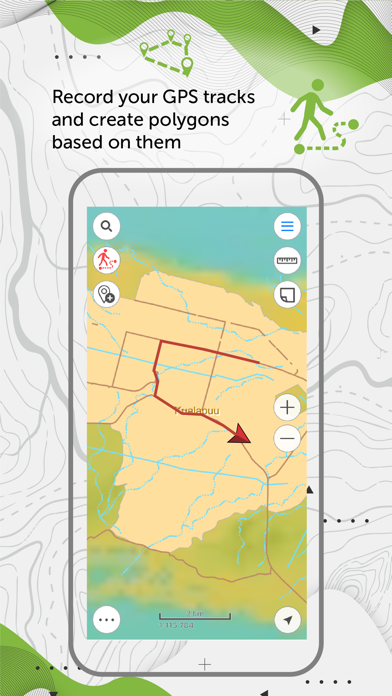
Create polygons from GPS tracks
Minor fixes and enhancements
• Fixed error with opening some maps on devices with 458 dpi.
• Enhanced track recording option in background mode.
• Minor fixes and enhancements.
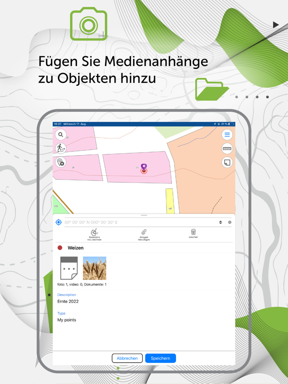
Viewing and adding media files directly from identification card
Saving selected map extent as bookmark for quicker access
Importing/exporting points, polylines and tracks in GPX format
Using WMS services as online basemaps
Improved search in offline maps gallery
Printing and sharing selected map area as PDF file
Performing measurements from current location
Setting custom map scale by tapping scale bar
Localization to German
Minor fixes
You are always welcome to share your ideas and comments regarding CarryMap app via Contact developer link or at support@dataeast.com.
CarryMap Team
Attachments – now not only photos can be added to objects, but also documents in PDF, Word, and other formats.
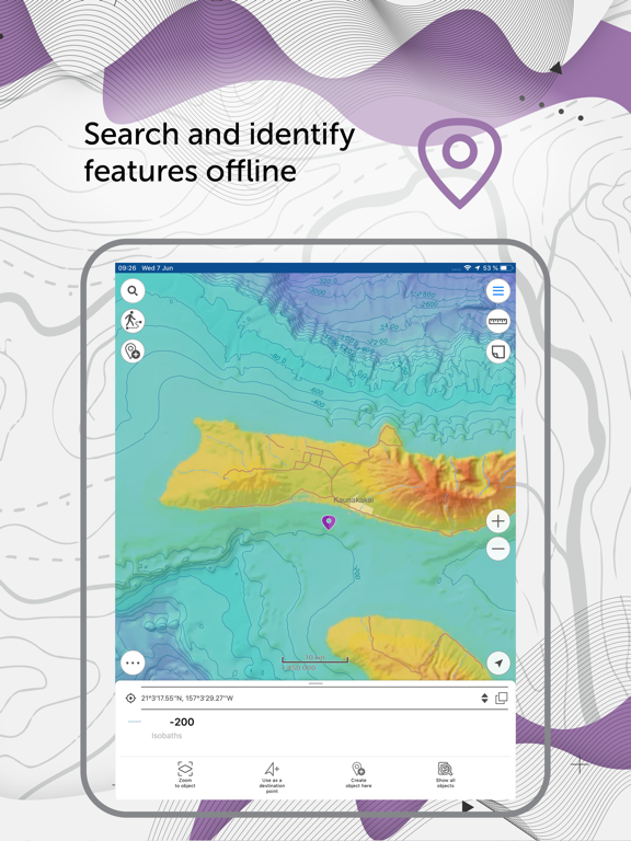
Objects search – now search results are displayed on the map.
Map gallery – a new option of downloading multiple maps from gallery has been added, at that the background mode of download enables seamless and full functional work with the app.
My location – zooming to current location and movement of the location arrow icon are now smoother.
App interface now automatically adjusts depending on screen orientation.
Battery charging has been optimized.
Minor bug fixes and enhancements.
You are always welcome to share your ideas and comments regarding CarryMap app via Contact developer link or at support@dataeast.com.
CarryMap Team
Fixed error resulted in the app closure while objects identification on iOS 12 devices.
Minor fixes and enhancements.
This release mostly represents the app interface changes. Renewing the app design, we wanted to make it more intuitive and easy-to-use.
What awaits you in the new version?
• New updated interface;
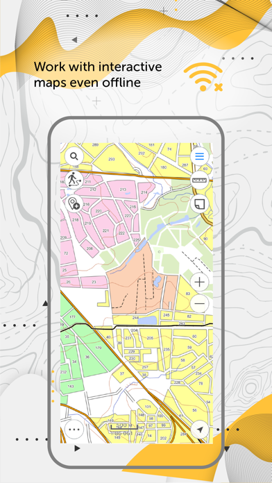
• Offline maps gallery;
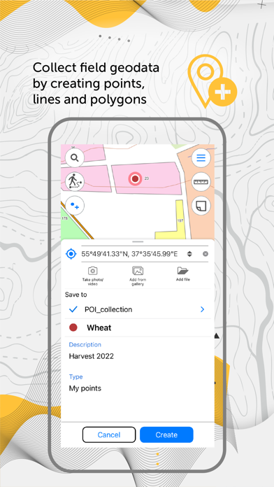
• Simplified UI/UX for field data collection option;
• Support of external Bad Elf GPS devices;
• The ability to cash online maps;
• Support for shapefiles;
• QR scanner - the ability to fill attributes by using QR code;
• Direction to the selected object - the ability to use specific object on the map as a target, where the arrow indicates the direction of movement, and the target object is marked with a flag symbol;
• The ability to specify different symbols for point objects (as colored pushpins and other icons);
• The ability to change the shape of Labels, My location, and Targets icons;
• The ability to record tracks during the data collection autosaving the track every 5 seconds;
• Minor fixes and enhancements.
Please note that in the next updates we are going to implement a lot of new functionality requested by our users. You are always welcome to share your ideas and comments regarding CarryMap app via Contact developer link or at support@dataeast.com.
CarryMap Team
- Fixed bug that prevented users from adding Google Drive account
- Fixed bug that caused attachments to be lost when sharing single layer from GeoPackage file
- Added compatibility with maps made with the latest CarryMap Builder version
- Other bugfixes and improvements
- Fixed bug that caused app crashes on iPhone 5c and iPad 4
- Cascade layer visibility toggling option added
- Reset layer visibility option added
- ArcGIS Online maps now can be added to sidebar basemaps list
- Project names now are generated automatically when creating projects to simplify this process
- Other bugfixes and improvements
- GeoPackage files now can be viewed from Maps tab of library
- Disable screen lock option added
- Object geometry now can be edited only after selecting "Edit" option to avoid accidental editing
- Tracks now can be recorded while screen is locked or app is in the background
- Other bugfixes and improvements
- Fixed bug that caused object creation and modification date to be saved incorrectly and as a result data could not be imported to ArcGIS
- Opening CMF2 maps from other applications is now more convenient
- Fixed bug that caused identification cards of maps converted from .cmf to .cmf2 not to display correctly
- Other bugfixes and improvements
- Fixed a bug that caused app crash when viewing .cmf2 that include rasters and online basemaps at the same time
- Fixed wrong layer order in map legend
- Now messages in pop-up windows that appear when you open .cmf files display in proper language
- Other minor bugfixes and improvements