Spyglass é um conjunto de ferramentas GPS essencial para a navegação ao ar-livre e fora de estrada. Com várias ferramentas, serve como binóculos, ecrã de aviso, bússola de alta tecnologia com mapas, bússola giroscópica, recetor GPS, seguidor de pontos de navegação, velocímetro, altímetro, pesquisador de Sol, Lua e estrelas, giro-horizonte, pesquisador de alcance, conversor de coordenadas sextante, inclinómetro, calculadora angular e câmara. Guarda lugares personalizados e pontos de navegação, navega precisamente para estes mais tarde, mostra-os em mapas utilizando realidade virtual aumentada em tempo real, mostra informação GPS detalhada, mede distâncias, tamanhos, ângulos e faz muito mais.
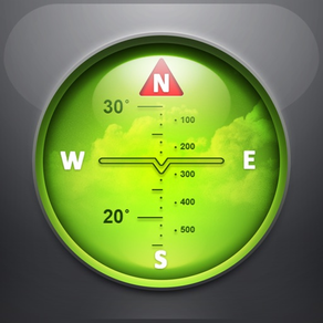
BÚSSOLA E BÚSSOLA GIROSCÓPICA
Técnicas de melhoramento de precisão, modos especiais de bússola e métodos de calibração disponíveis no Spyglass tornam-no num instrumento real – a bússola digital mais avançada e precisa.
PESQUISADOR, SEGUIDOR E NAVEGAÇÃO AR
Spyglass opera em 3D e usa realidade aumentada para mostrar em tempo real as posições dos objetos, informação e direção para estes sobrepostos à câmara ou mapas.
Guarde a posição atual, adicione pontos a partir de mapas, manualmente introduza as coordenadas e direções da localização, adicione estrelas à mão ou use um catálogo incluído de estrelas.
Encontre lugares guardados e objetos mais tarde simplesmente ao seguir setas direcionais.
Spyglass segue múltiplos alvos simultaneamente e mostra a sua informação – distância, direção, azimute, elevação e hora estimada de chegada.
Copie, cole e partilhe localizações, coordenadas e ligações do mapa usando muitos formatos suportados.
GPS, VELOCÍMETRO E ALTÍMETRO
Procure e siga a sua localização e obtenha dados GPS detalhados em tempo real – coordenadas em dezenas de formatos, altitude, direção, velocidade atual, máxima e vertical, usando unidades imperiais, métricas, náuticas e topográficas.
MAPAS
Veja a sua posição e a dos seus alvos em mapas usando diferentes estilos de mapas e fornecedores de mapas alternativos – planeie pontos de navegação e meça distâncias.
SIGA AS ESTRELAS, O SOL E LUA E NAVEGUE PELAS ESTRELAS
Siga as posições de estrelas, Sol e Lua com precisão ao de arco-segundo – use-as como referência para calibrar a bússola para a melhor precisão.
PESQUISADOR DE ALCANCE ÓTICO
Meça distâncias aos objetos em tempo real com um retículo de pesquisador de alcance semelhante ao visor dos atiradores furtivos.
SEXTANTE, CALCULADORA ANGULAR E INCLINÓMETRO
Descubra a altura dos objetos e as distâncias a estes – meça visualmente e calcule dimensões e distâncias.
CÂMARA
Tire fotografias sobrepostas com todos os dados de GPS, posicionais e direcionais disponíveis.
DEMO E AJUDA
Videos:
http://j.mp/spyglass_vids
Manuais:
http://j.mp/spyglass_help