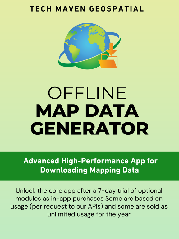
Discover the Ultimate Mapping Experience with Tech Maven Geospatial
Unleash the power of geospatial data with Tech Maven Geospatial, your all-in-one mapping solution available now on iOS! Whether you're a seasoned explorer, a professional in the field, or an enthusiast, our app provides unparalleled features to elevate your mapping endeavors.
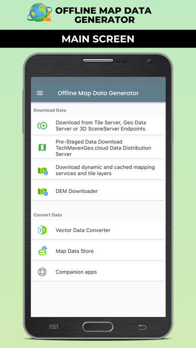
Key Features:
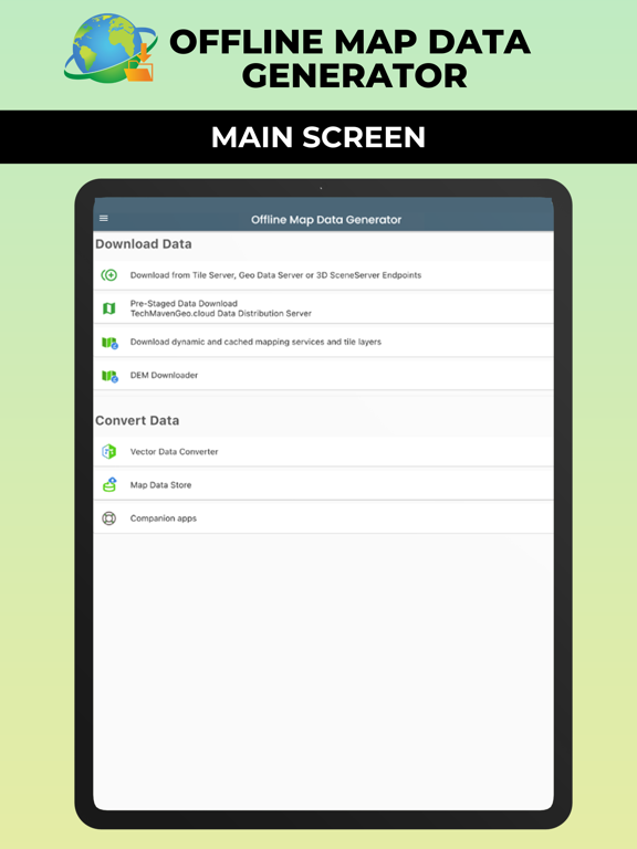
1. Seamless Data Access:
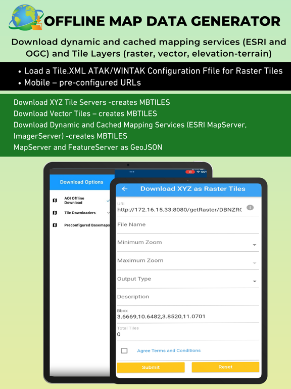
Download online mapping URLs, including dynamic and cached mapping services and tile layers.
Access ESRI MapServer, FeatureServer, ImageServer, VectorTileServer, PBF/MVT XYZ Vector Tile URLs, OGC API Tiles/XYZ/TMS, and more.
Future versions will include downloading capabilities from other providers (OGC WFS/OGC API Features, OGC WMS/OGC API Maps, OGC WMTS).
2. Pre-configured Tile Layers and Conversion Tools:
Support for pre-configured tile layers and the ability for ATAK/WINTAK users to import tile.xml configurations.
In-app Vector Data Converter: Convert GIS Vector Data to optimized formats like MBTILES Vector Tiles, GPKG Vector Features, GeoJSON, or KML. Compatible with various file formats including ESRI FileGDB, Shapefile, MapInfo, GPX, CSV, and more.
3. Live Event Driven Data Feeds:
Stay updated with live data feeds from ESRI FeatureServer, Network Link KML, and GeoRSS Feeds.
Download data at specified frequencies and convert to GeoJSON (convertible to KML in-app for ATAK or iTAK).
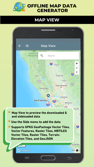
4. Data Visualization and Sharing:
Visualize downloaded data and user-loaded data in the Map Viewer.
Supports GeoJSON, raster tiles from MBTILES and GPKG, and vector tiles from MBTILES.
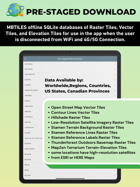
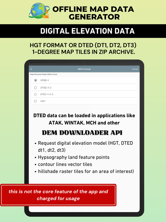
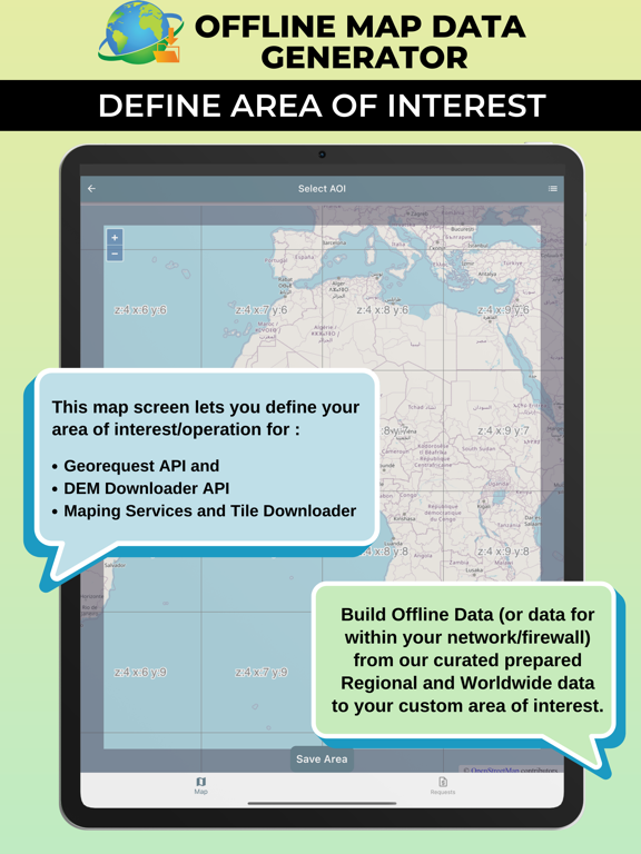
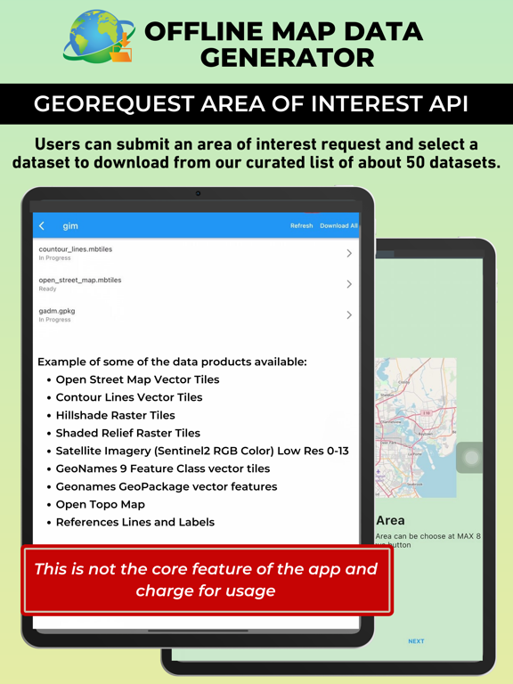
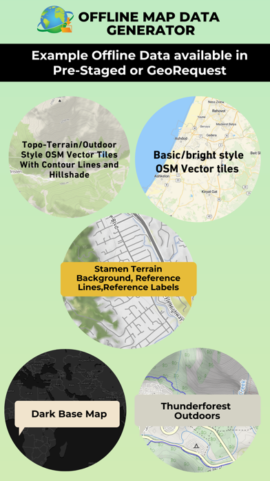
5. Access Tech Maven Geospatial’s Data APIs:
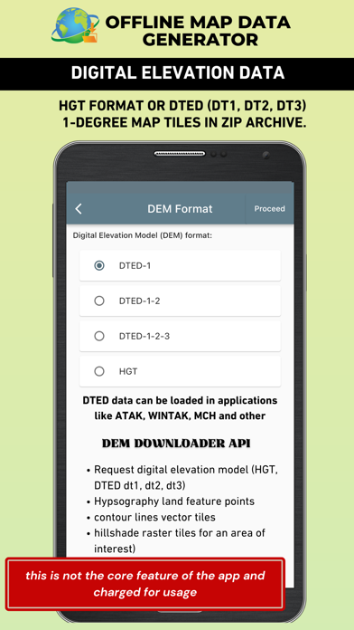
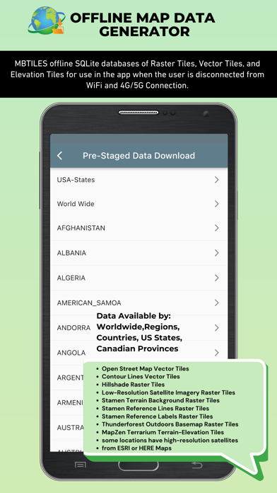
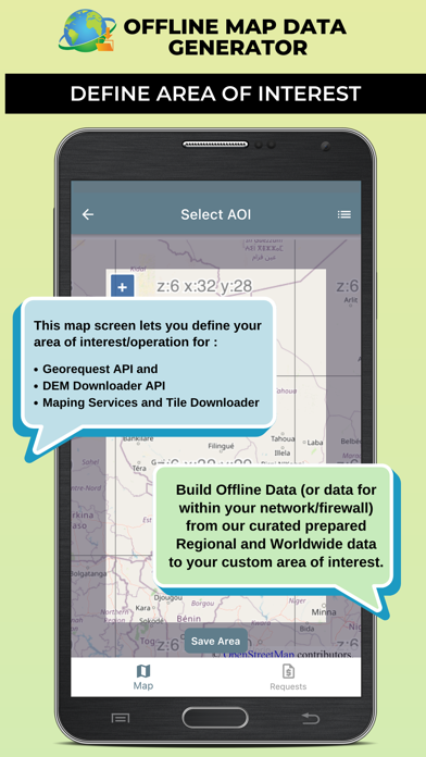
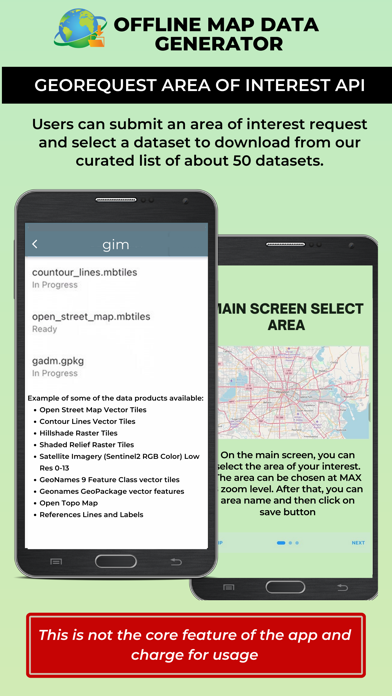
Explore our optional purchases to access Tech Maven Geospatial’s data APIs, offering pre-staged data, AOI (Area of Interest/Operation) APIs, Digital Elevation Model Downloaders, and more.
Please note: Users are responsible for the terms of use/service and access to the data they download from the provided URLs.
For detailed terms and conditions, please refer to our End User License Agreement (EULA): https://offlinedatadownloader.techmaven.net/eula/
Download Tech Maven Geospatial today and embark on your mapping journey with confidence and precision!